Copyright:Babak Tafreshi
原文:
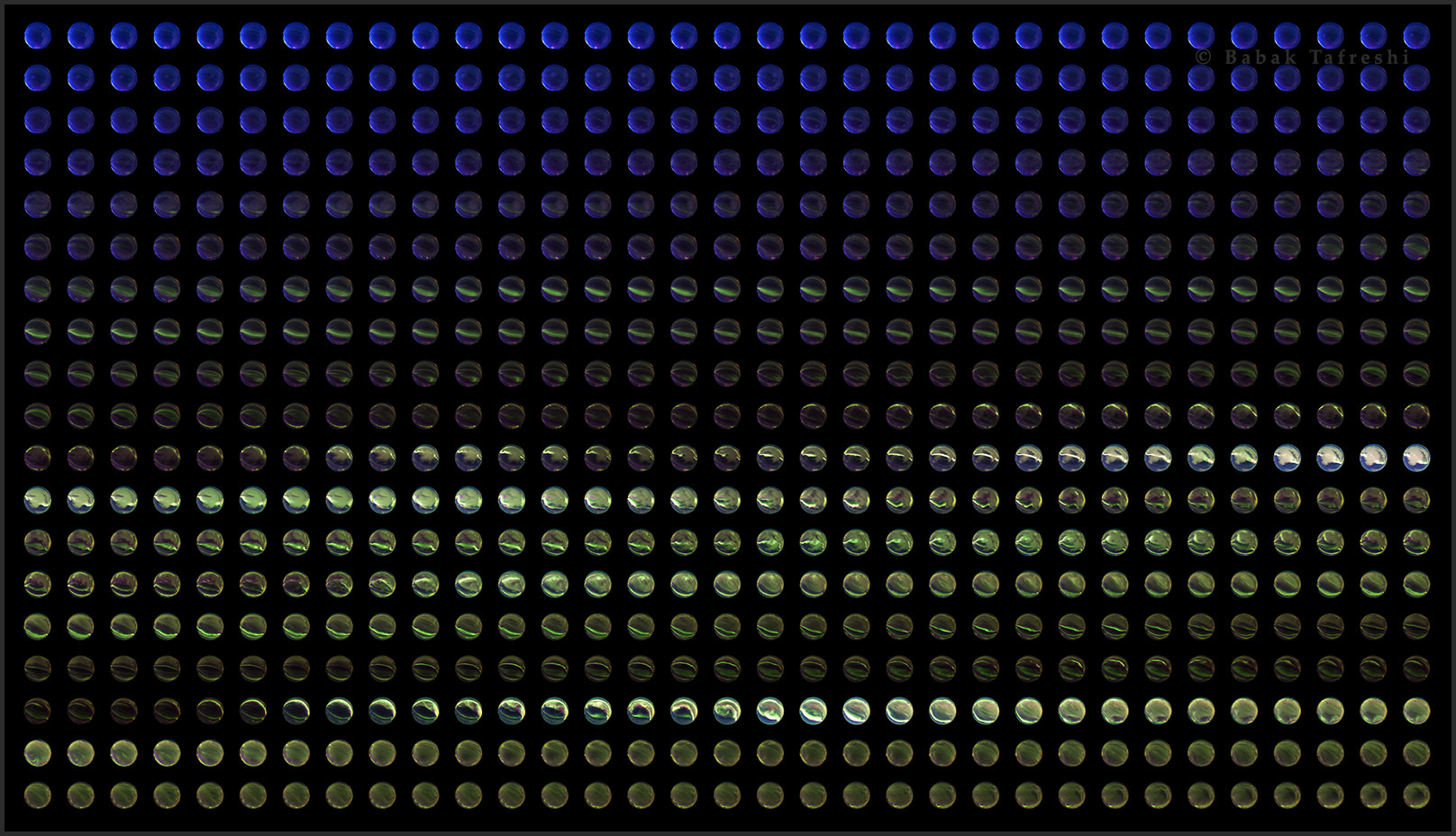
It looks like a fine collection of aggies. But this grid of embedded swirls and streaks actually follows the dramatic development of planet Earth’s auroral substorms. The sequence of over 600 horizon-to-horizon fisheye images was taken over a 2 hour period near the artic circle in March of 2012 from Lapland, northern Sweden. It begins at upper left in evening twilight and ends at lower right, covering two activity peaks with bright coronae forming overhead. While exploring space between Earth and Moon, NASA’s fleet of THEMIS spacecraft discovered that these explosions of auroral activity are driven by sudden releases of energy in the Earth’s magnetosphere. Even if you’re not playing for keepsies, you can follow this link to check out the sequence in a full timelapse video (vimeo).
中文翻譯:
這看起來是一組精美的極光圖像。然而,這個充滿漩渦與條紋的網格實際上展示了地球極光亞暴的戲劇性發展。這組超過600張的魚眼影像是於2012年3月在北極圈附近的拉普蘭(Lapland)拍攝的,總共花了兩小時的時間。影像的開始在左上角的黃昏時分,結束於右下角,涵蓋了兩個活躍高峰期,明亮的圓冠在頭頂上形成。NASA 的THEMIS太空船在探索地球和月球之間的空間時發現,這些極光活動的爆發是由地球磁層中能量的突然釋放所驅動的。即使你不是出於遊戲的目的,也可以透過這個鏈接來查看這個序列的全長時光滾動視頻(vimeo)。
#極光 #自然奇觀 #拉普蘭 #THEMIS #天文學 #極地探險 #地球磁層 #時光滾動 #夜空奇觀 #宇宙探索 #極光亞暴 #科學探索
來源:NASA每日圖片


