Copyright:
原文:
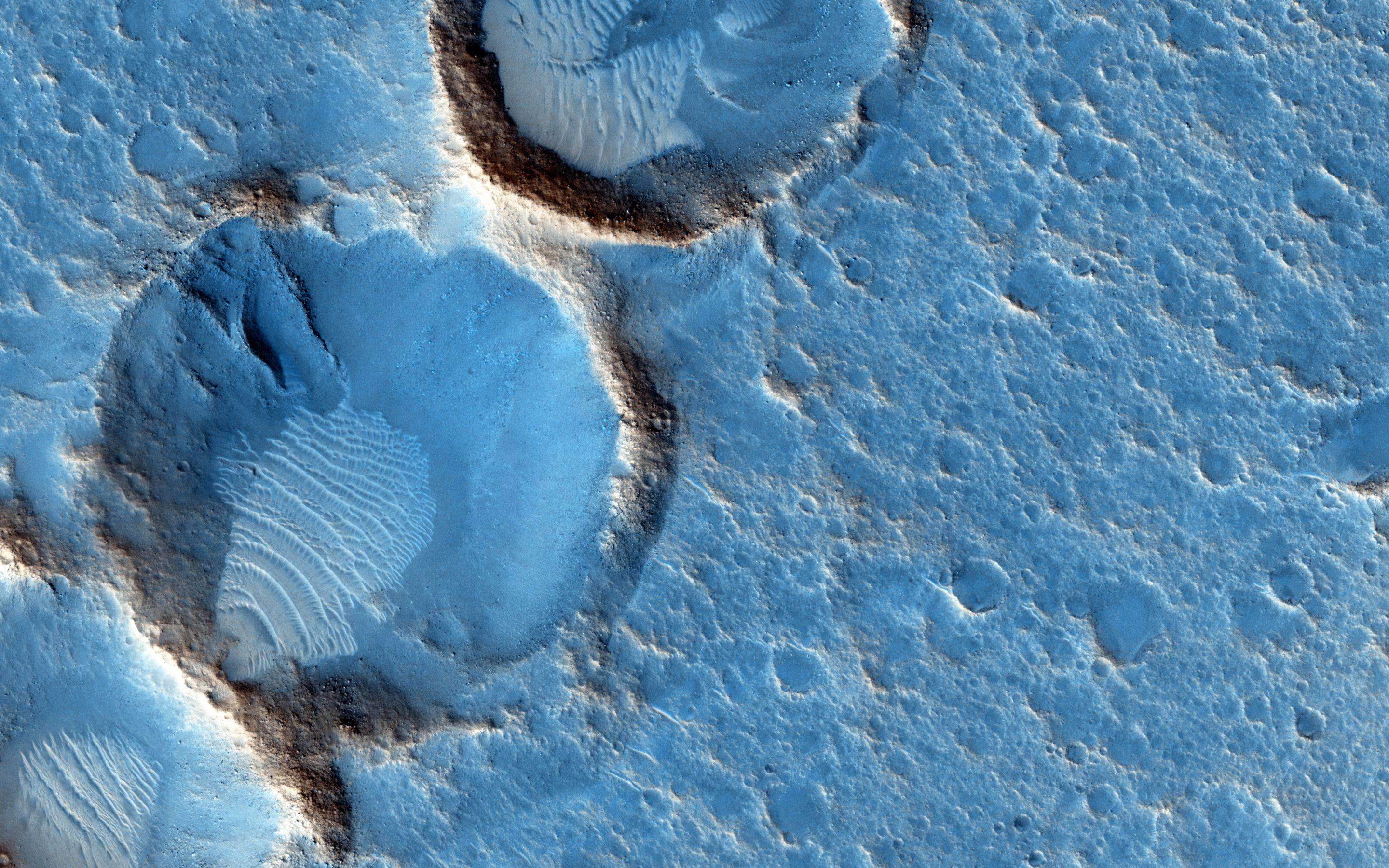
This close-up from the Mars Reconnaissance Orbiter’s HiRISE camera shows weathered craters and windblown deposits in southern Acidalia Planitia. A striking shade of blue in standard HiRISE image colors, to the human eye the area would probably look grey or a little reddish. But human eyes have not gazed across this terrain, unless you count the eyes of NASA astronauts in the scifi novel The Martian by Andy Weir. The novel chronicles the adventures of Mark Watney, an astronaut stranded at the fictional Mars mission Ares 3 landing site corresponding to the coordinates of this cropped HiRISE frame. For scale Watney’s 6-meter-diameter habitat at the site would be about 1/10th the diameter of the large crater. Of course, the Ares 3 landing coordinates are only about 800 kilometers north of the (real life) Carl Sagan Memorial Station, the 1997 Pathfinder landing site.
中文翻譯:
這幅來自火星探測軌道器 (Mars Reconnaissance Orbiter) 的 HiRISE 相機的特寫圖像顯示了南部酸谷平原 (Acidalia Planitia) 的風化隕石坑和風灘沉積。該區域在標準 HiRISE 圖像顏色中呈現出引人注目的藍色,但對於人眼來說,這裡的顏色可能看起來灰色或稍微帶紅。然而,真正的人眼還沒有親自看到這片地形,除非算上安迪·威爾 (Andy Weir) 的科幻小說《火星救援 (The Martian)》中的NASA宇航員的眼睛。這部小說講述了被困在虛構的火星任務 Ares 3 登陸點的宇航員馬克·沃特尼 (Mark Watney) 的冒險故事,該登陸點的坐標與這幅 HiRISE 圖像中的裁剪區域相符。為了參考,沃特尼的直徑6米的棲息地在該區域大約是大隕石坑直徑的1/10。此外,Ares 3 的登陸坐標距離真實的卡爾·薩根紀念站 (Carl Sagan Memorial Station) 僅約800公里,後者是1997年探測器 (Pathfinder) 的著陸點。
#火星探測 #HiRISE #南部酸谷平原 #火星 #科幻小說 #火星救援 #馬克·沃特尼 #宇航員冒險 #NASA #太空探索 #科學攝影 #探索宇宙
來源:NASA每日圖片


