Copyright:
原文:
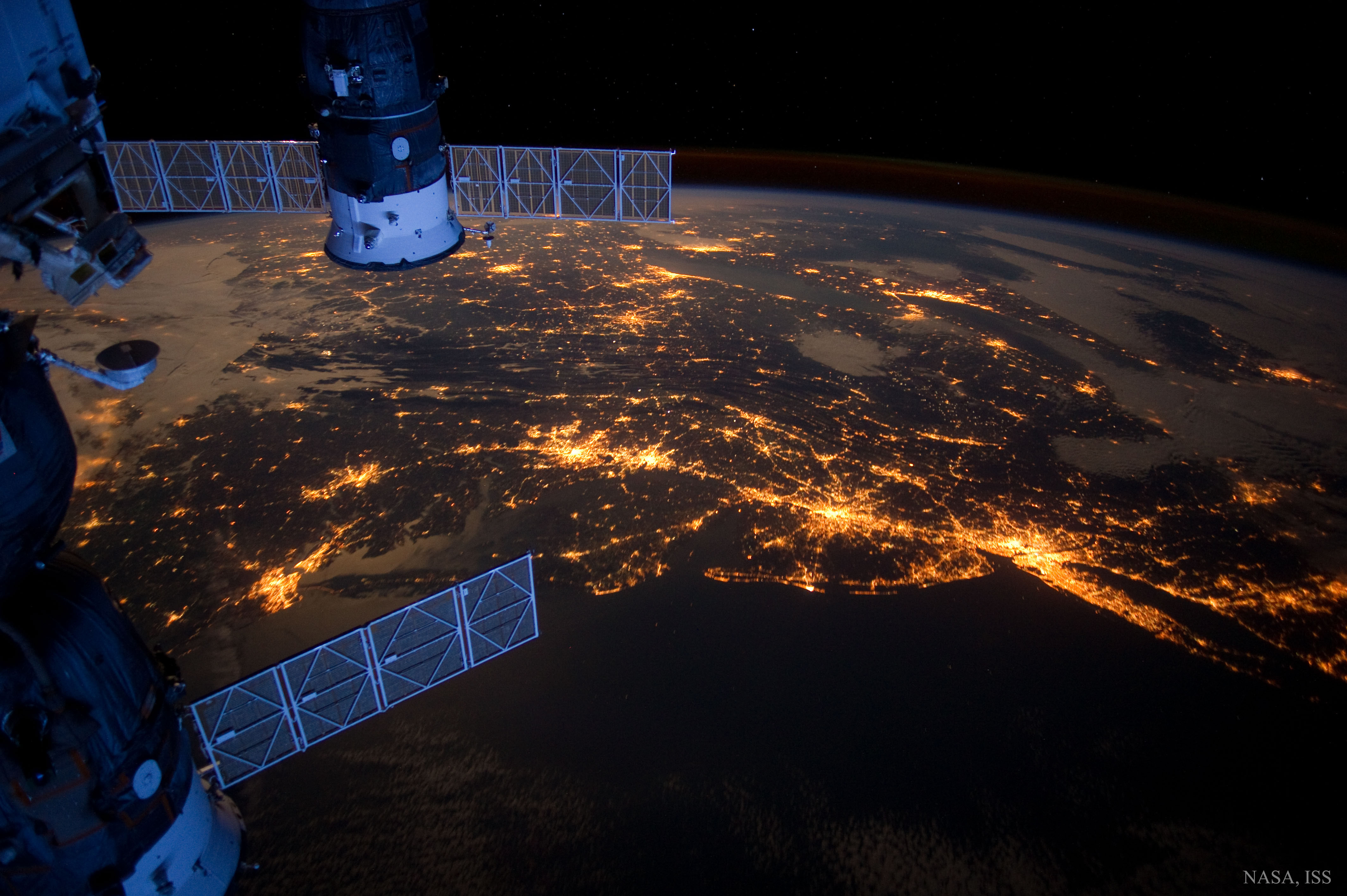
Can you identify a familiar area in the northeast USA just from nighttime lights? It might be possible because many major cities are visible, including (right to left) New York, Philadelphia, Baltimore, Washington, Richmond and Norfolk — Boston of the USA’s Northeast megalopolis is not pictured. The featured image was taken in 2012 from the International Space Station. In the foreground are two Russian cargo ships with prominent solar panels. This Northeast megalopolis of the USA contains almost 20 percent of the people of the USA but only about 2 percent of the land area. Also known also as the Northeast Corridor and part of the Eastern Seaboard, about 10 percent of the world’s largest companies are headquartered here. The near continuity of the lights seem to add credence to the 1960s-era prediction that the entire stretch is evolving into one continuous city.
中文翻譯:
🌆 根據這張2012年從國際空間站拍攝的夜景,我們可以輕鬆辨認出美國東北部的繁華地區。從左到右,可以看到紐約(New York)、費城(Philadelphia)、巴爾的摩(Baltimore)、華盛頓(Washington)、里士滿(Richmond)和諾福克(Norfolk)。雖然波士頓(Boston)未被納入此圖,但該地區依然是美國人口的集中帶,約佔全美人口的20%,卻只佔2%的土地面積。
這個被稱為東北走廊(Northeast Corridor)和東海岸(Eastern Seaboard)的地帶,是全球最大的公司之一的總部所在地,約有10%的世界500強企業在此擁有辦公室。這片區域的燈光幾乎是連綿不絕,這也使得1960年代的預測成為可能,顯示這一帶正一步步演變成為一個持續的城市。
#NortheastUSA #NighttimeLights #UrbanDevelopment #NortheastCorridor #MegaCity #InternationalSpaceStation #CityLights #UrbanGrowth #NYtoDC #MajorCities #SpacePhotography
來源:NASA每日圖片


